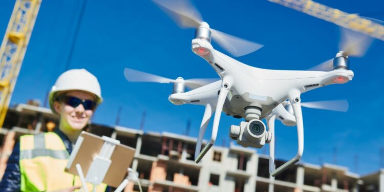
As all construction teams know, disputes are commonplace on the jobsite. Rarely is a project completed without conflicts related to work progressions, time extensions, and delays along the way. Before drone survey technology arrived on the scene, resolving disputes was often difficult without accurate, frequent data about conditions on the ground. More and more, construction teams are relying on drone photogrammetry software to provide an accurate record of activities on-site. It’s improving dispute resolution.
Speed and Accuracy
Drone photogrammetry is a quick, affordable way for construction teams to collect data on the jobsite. Companies like Propeller Aero transform data collected by drone into topographic maps of construction sites, providing all stakeholders involved on a project with accurate information of the original state of a site, as well as current conditions on the ground. Since regular surveys of construction sites using a drone are faster, easier, and more affordable than traditional survey methods, teams are able to accurately monitor progress, with weekly updates in many cases.
The result is a complete record of activities at a site. This leads to data-backed verification of work, which can resolve disputes faster. Moreover, a regular top-down view of the site can even mitigate potential disagreements before they develop.
Early Insights
Start your project off right by surveying your site with a drone as early as possible – even before you move a single inch of dirt. Getting accurate data early on helps with project planning logistics. Even more importantly, it helps you catch data discrepancies early.
An initial time-stamped survey gives you a baseline of exactly what you’re working with. It serves as a record of conditions that existed before your team got to work. When measured against surveys performed throughout the project, you can show clients exactly what you’ve done on a site and compare it to the initial surface information you collected at the beginning.
Visual storytelling is a great way to mitigate conflict and explain unforeseen challenges in the timelines. It’s a source of truth that promotes critical decision-making that might otherwise prompt disagreement.
Avoiding Change Orders
Put simply, change orders disrupt project workflows. Profitability for nearly every project depends on following strict timelines, and contractors often need to adjust entire schedules to incorporate new changes in the construction process. Conflicts inevitably arise when clients request a change order that’s not cost-effective for your team. In some cases, it may be completely outside the scope of agreed-upon work.
Aerial survey data gives you the leverage you need to negotiate change orders that can negatively affect operations and the bottom line. Now, construction teams with automated drone data processing workflows can use their most recent survey data to support their position. When more up-to-date information is needed, teams can simply fly the site again and obtain updated data — often in less than 24 hours. Say goodbye to unnecessary conflicts and keep projects on track.
Wrapping Up Projects the Right Way
Ready to finish a project? It’s not uncommon for conflicts to arise both during and after the completion phase. As the project owner compares conditions on the ground to the design proposal, any discrepancy can be cause for conflict.
Always take a final flight when you’ve completed a project, so you have accurate documentation of the site as you left it. If your client examines the site months later and finds it doesn’t meet their expectations, data collected by drone is the best way to resolve potential conflicts and relieve your team of any responsibility for deviation.
Conflict Doesn’t Need to be the Norm
Conflict-free construction is well within reach with drone data. Drones make regular flights accessible and affordable and provide the frequent documentation construction teams need to measure their work against design. The end result is a better process for all project stakeholders from design to completion.


